Saturday, August 28, 2010

Mount Harvard and Mount Columbia 8/26/2010

Roundtrip Mileage: 15 miles
Roundtrip elevation: 12,200 ft.
Starting point: North Cottonwood Creek Trailhead


Mount Harvard is the third highest peak in Colorado and the highest peak I've climbed to date. I was very excited for this combo hike. I have heard that the standard western slope route up Columbia sucks a fatty so I figured if I did the loop I could avoid going up the west slope but would still come down it. I was very glad I had done that by the end of the day.

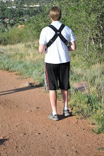
I left my house at 4am and arrived at the trailhead at 6:30am. I finally bought gloves which came in very handy (get it!). It was a cool morning and the first three miles went by quickly for me. This was my first time using trekking poles and I must say, I'm a believer. I still think they look really stupid, but they're as helpful as they are dorky. Right before treeline I hit a clearing and got my first glimpse of Mount Columbia.


A little further up Harvard came into view. As I stood taking this picture I realized that from this point I had three different views of three different 14ers.

To the north: Harvard


To the east: Columbia

And to the south: Yale

At this point I was in what's called the Horn Fork Basin. Apparently it's a popular place to camp for those attempting Harvard, Columbia, or both. I didn't see a single soul though. Pretty nice actually. From the top of Columbia I got a picture that shows much of the route from treeline to the summit of Harvard.

The red is a rough idea of the route I took.

Conditions were ideal for me. No clouds, no wind, no people. I've always been dead tired when I've reached the top of a 14er. After reaching Harvard's summit I felt fantastic and not anywhere close to out of gas. I had told myself that two things would turn me back at this point. If the weather was questionable or if I felt spent physically. Neither was the case so I decided to continue on to Columbia.

The most fun I've had on any 14er was climbing the last 30-40 feet to the summit of Harvard. It requires actual climbing and upper body strength to get there. And you know I've always been known for my upper body strength. Here's a pic of the final pitch.


Over those rocks and I had the summit all to myself.

No people so I had to rely on auto-timed pictures all day.

I took a video showing the 360 degree view from Harvard's summit.


So I stayed on top for about 20 minutes. I enjoyed the views, some food and some Gatorade and continued on to what would be the most taxing portion of the day. Hiking the traverse isn't as easy as just following the ridge all the way there. From Mount Harvard (14,420 ft) you drop down into a basin that is about 12,900 ft. How you get there and how far you drop in elevation is up to the hiker. Close to halfway between Harvard and Columbia there is an unnamed 13,000+ ft. peak. It is here where the hiker must choose to descend gently down this ridge increasing mileage or drop abruptly down a gully of loose rock cutting off a bit of the route. I chose the gully and deeply regretted it. Coming down the loose rock I found myself surfing rock slides for about 3-4 feet at every step. At one point I needed to slow myself down which I did very forcefully with one of my trekking poles. It stopped me but was snapped nearly in half in the process. It was unusable the rest of the day. In addition to that my knees took a pretty bad beating. If you choose the gully you don't need to drop down in elevation as much as long as you don't mind hiking on loose rock. I did mind though after coming down that gully. I continued down into the basin ending up where I would have ended up had I chosen the gentle descent. At the bottom I looked back to see the gully. The red indicates my route and the black is where I should have gone.


From the basin I could hike nearly the rest of the way on softer grassy terrain. My knees were bothering me so that's what I chose to do. Excluding the last 200-400 vertical feet to Columbia I was able to continue hiking on soft grass. It was slow-going but I felt no need to push myself knowing that the descent down Columbia would be coming soon. Close to the top of Columbia I saw a great view of Mount Princeton and Mount Yale together.

I actually had really good phone reception here so I called my wife to check in. (Brownie points!!)

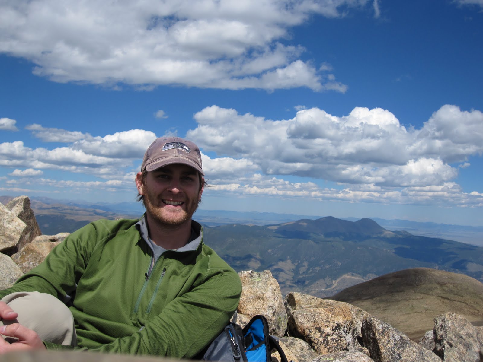
I finally made it to the top at 2:30pm. It took 3 hours and 20 minutes just for the traverse. I had anticipated finshing that part in about 2 hours so I was surprised at how long it took. I ate some delicious PB&J dessert treat my wife made and headed down after taking this summit shot.

So I began the dreaded descent and I honestly expected the worse. Truth be told the gully I descended on the traverse was much worse. Also, much shorter to be fair. It wasn't so much the steepness down Columbia but the length that got to me after going down about 2/3 of the way. It just never ended. I passed a group of four climbing down that had climbed up the same way. Pretty impressive climb in my opinion. One that I do not plan on doing anytime soon. On the descent I grabbed one more shot of Harvard that also shows a bit of the steep slope I'm standing on.


One of the sloggiest slogs any slogger could ever slog. It sucked.

From the bottom of that western slope I was back in the Horn Fork Basin where I had been earlier that morning. I was about three miles from the trailhead and I enjoyed the leisurely stroll back to the car. Though by this time even a leisurely stroll was tough on my knees. I made good time back and arrived at my car at 5:25pm. A record 11 hour hike for me.

The worst decision of the day came on way home. I stopped at a gas station and bought a 44oz Mountain Dew so that I wouldn't get drowsy on the home (2 hour drive). I don't drink soda regularly let alone Mountain Dew. Mountain Dew was a bad choice. By the time I got home I was feeling mild symptoms of food poisoning. (Not that I think I had food poisoning. I just felt the same symptoms.) It lasted for about 6 hours and then by morning I was fine.

The next thing I have planned is in mid-September my Dad and I will hiking Pikes Peak. In late September I'm kicking around doing another combo. Maybe Castle Peak and Conundrum Peak. So to all my loyal readers, you will both have to wait until then for my next post. So sorry :(

Notes to Self:
-buy binoculars
-bring ibuprofen with me
-read trip reports over and over. No such thing as too familiar with the route

Saturday, August 14, 2010

Mount Yale 8/13/2010

Roundtrip Mileage: 8 miles
Roundtrip Elevation: 8,600 feet
Starting Point: Denny Creek trailhead


Mount Yale from the north.


This was a really fun hike for me and, by far, harder than the other two 14ers I've done. I was out the door from home at 4:00am. That put me at the trailhead at 6:15am. I got off to a slow start due to me second guessing myself. The trail reports I had read in preparation for this hike describe a sign that you encounter at which point, you turn right. The first sign I ran into was this one.


There was a less obvious trail that went off to the right so I had to stop for a second. I was only about .25 miles into my hike when I encountered this sign so I thought it couldn't be the right one. I was correct. I just didn't know it yet. I kept on, and arrived at a stream that I had to cross to continue. It was at this point that I turned around after convincing myself I had missed the turn. On my way back I ran into a nice woman who was headed to the summit. I told her what I was doing and why. She was pretty confident she was going the right way. She was right. I just didn't know it yet. I continued on my way and her on hers. A little later I ran into a nice couple heading for the summit as well. I recounted my intentions once more and they were very sure that I was very wrong. They had a topographical map of the area that showed conclusively that I was right initially, wrong currently, and ill-prepared practically (no map). So convinced of where I was supposed to go I headed off. I've added one mile to my roundtrip mileage above due to this error. I like to see what I can push myself to do physically and now I felt at a disadvantage for having to hike extra distance so I started hiking fast. I probably shouldn't have done that. Anyways further down the trail I ran into this sign.


I'm such a dummy sometimes. After working this out I continued on and the trail began to climb much more noticeably. The views were really impressive.


Not very much further and Mount Yale came into view.

A little further still and I could see the rest of my route. I would be hiking the northwest ridge which is the left side of the summit seen here.


And then to my right I see an old friend, Mount Princeton just poking up and over the ridge.


From this point to the saddle it was grueling to say the least. I had seen on some lists that Yale was rated as a more difficult climb then Princeton or Pike's Peak. The elevation gain seemed so dramatic in the last two miles that I would have to agree to that rating of Yale. My legs were starting to really burn. I kept on at a snail's pace but felt good to be constantly moving. As I got higher up the mountain the wind increased. I actually became quite cold and I remembered my "Note to Self" from Pike's Peak to wear gloves. I should really listen to myself more often. At the saddle I experienced wind like I never have before. Roaring over the saddle the wind forced me to remove my hat and sunglasses. I was only a mere 300 vertical feet from the summit but turning back crossed my mind for a moment. I'm new to 14ers and tend to error on the side of overly cautious. After short contemplation I continued onward and upward. Route finding from here to the top became critical. Having people pass me helped a lot. When I hit the saddle I new I wouldn't be staying on top for more than about five minutes. I stayed true to that. I reached the summit at 9:56am, took a few snapshots and began my decent before 10:00am.
Mount Princeton to the south.
The little town of Buena Vista to the east.

Mount Harvard at center and Mount Columbia to the right. From the summit of Mount Yale 14,196 feet.


My hands were freezing, but on the way down I wanted to try and capture a video of the wind. I was talking loudly to the camera but you can't really make out what I'm saying. I was trying to hold my backpack up to show the force.


It was a pretty quick hike down. I got to my car at noon exactly. So 5.75 hours up and down. I know there are more difficult 14ers out there but I was glad to have Yale behind me.

Notes To Self:
-invest in maps
-buy gloves
-wind can be quite a deterrant to hiking
-buy gloves

Pikes Peak 7/31/2010

Roundtrip Mileage: 13.0 miles
Roundtrip Elevation: 8200 feet
Starting Point: Crags Campground trailhead

I didn't take this but it's Pike's Peak from the east.

So what's nice about Pike's Peak is the proximity to my house. It's literally the only 14er that isn't a two hour drive or more. The insanely popular Barr Trail trailhead is only about 20 minutes from my house. I took a different route that travels up the northwest slopes to the summit. The Barr Trail is a 25 mile roundtrip hike and I just don't think I'm ready for that yet. Driving to the Crags trailhead took about 35 minutes and I started for the summit at about 5:45am. I chose to go on a Saturday, so starting as early as possible turned out to be a good idea.

As soon as my target comes into view I try to take a picture. Most summits wont be visible from the trailhead but by the time you pass the treeline, I've found they usually are. Here's Pike's Peak as soon as I saw it.


If you zoom in you can see the cafe/gift shop on the summit.

The hiking got pretty easy from here until the final pitch to the summit which was difficult. I passed through some very scenic areas on the way there.

This place is called Devil's Playground because of the lightening that jumps from rock to rock during storms.


Same area here. I was trying to take a picture of just the landscape and this guy here comes around the corner and scared the crap out of me.


I thought the next part of the hike was going to be kind of lame because I had read that it follows closely the Pike's Peak tollway that goes all the way to the summit. For the modest price of $35 you can drive your car to the top of Pike's Peak. Turns out, the hike just got better and better. Some clouds started to roll in but they were light and wispy and didn't completely obstruct the views. While to my right was a road, part dirt part asphalt, to my left were ominous cliffs that seemed to drop forever.


The final pitch was difficult but much easier than Princeton had been. I'm always amazed when I see how paths have been carved into these massive boulders. It would be fun to make trails I think. Well, maybe just fun to think about making trails. This shows the general route I took. Picture was taken from 14ers.com.


The top of Pike's Peak is unlike any other summit in Colorado. You can't summit any other peak in Colorado and find 500 people waiting for you, buying souveniers, taking pictures, eating food from the cafe, or just enjoying the views. Few of these people hiked to get there. There's the road I've already mentioned but there's also a cog train that ferries people to the top. It's actually quite neat.

There's also the "World Famous Pike's Peak Donuts." After trying one I realize they're famous because they're three dollars and not for any other reason. Alas, I had to try one to say I did it. I brought one home for my wife to try as well. They're good.... but not three dollars good.

Obligatory summit pics.


Looking northeast from Pike's Peak summit.

Another unique aspect of climbing this mountain. You won't find cool signs like this on other mountains.

I stayed on top for about 30 minutes and then headed down. It was actually quite cold. The rocks on the way down hadn't seen any sun yet and they were wet. So using my hands to brace my decent against the rocks left my hands very cold. Once down the initial section it was smooth sailing. There must have been a convention or something because I passed about 100 people on the way down. It was clear they were together but not clear what kind of organization they were with. I got to my car at about noon. So total time out was about 6.25 hours. Much improved from my Princeton times.

My 2nd 14er and I feel much more confident. More to come....

Notes To Self:
-bring gloves
-cotton shirts on morning hikes cause dew to collect and I end up drenched
-still need hiking boots

Mount Princeton 07/12/2010

Roundtrip Mileage: 13.0 miles
Roundtrip Elevation: 10,800 ft.
Starting point: Mount Princeton Trailhead


I left my home in Colorado Springs at 4:30am and set out for the Mount Princeton trailhead. I arrived at 6:30am and began the trip up. At the trailhead you may continue by car up the 4x4 road for 3-4 more miles. There are various parking spots but the road is very narrow and turning around is very difficult. Not trusting my car entirely I began my hike from the trailhead and hiked the 4x4 road by foot. This added a considerable amount of mileage to the trip. I didn't mind this mileage on the way up. I had underestimated the amount of water that I needed and on the way down I was wishing I could be done.


There comes a point where you must leave the 4x4 road and follow a foot trail the rest of the way to the summit. Right at treeline the trail creeps up and this is where the real hiking begins.
Looking east, standing above the 4x4 road on the foot trail leading to the summit.


A short ridge quickly appears and once above that ridge Mount Princeton comes into full view.

Another picture (not taken by me) shows the general route I took to the summit.


Upon reaching the saddle a great view of Mount Antero is seen. This is another Colorado 14er.

Only about a mile left but the last mile is always the hardest for me. Usually because I'm at 13,000 feet elevation and leapfrogging over talus with virtually no trail. This is also the most rewarding part of climbing for me as well. Just before the summit I encountered this little reminder of how important it is pay attention to the conditions on the mountain.
Makes you want to keep on hiking right?

The summit was pretty awesome. I stayed on top for about 30 minutes. I had a little phone reception so I updated my Facebook status, took a few pictures and then began my decent.

A view of Mount Antero to the south from the summit of Mount Princeton 14,197 ft.

The decent proved more difficult than I had thought it to be. For much of the beginning of the decent I wasn't moving much faster than when I was going up. I wore trail shoes and in retrospect I would have brought hiking boots for that type of terrain. I have little chicken ankles that have a long history getting sprained. I had a few close calls but eventually I made it down unscathed.

I made back to the car around 3:00pm so all in all it took about 8.5 hours. A lot longer than what I thought it would take. At the car I was more thirsty than I can ever remember being in my life. Kind of a weird feeling. I found a gas station and guzzled down two bottles of water and a Powerade. On the hike I had brought two bottles of water and two bottles of Gatorade. For all you math wizards out there that's four bottles of water (80oz total) and three bottles of Gatorade/Powerade (72oz total). This doesn't become significant until I tell you that from 4:30am, when I left my house, until about 6:00pm that evening, I never peed once. Impressive, I know.

So, one down, 53 to go. It was a great feeling to accomplish this hike and claim my first 14,000 foot summit. At the end of these posts I will try to include things I learned so that I can be better prepared for my next attempt. They are mostly for my benefit so these sections will be called Notes To Self.

Notes To Self:
-bring more water
-hiking boots are preferable to trail shoes in medium talus
-wear sunscreen (or this happens)

This is about one week after the Princeton hike.

Friday, August 13, 2010

Introduction

The purpose of this blog is to archive my hiking adventures. My interest in hiking and climbing may seem newly found by those who know me. In fact, I have loved hiking ever since I can remember. My life has recently afforded me with more "free time" then has been previously available. Does my wife support me you ask? She loves me very much.


My primary goal is to summit all 54 Colorado 14ers. Trip reports will be posted here as they are accomplished. Here I am on my first 14er, Mount Princeton.