Friday, May 6, 2011

Mount Shavano and Esprit Point 5/4/2011

Total Mileage: ~8 miles
Total Elevation: ~5500 feet
Starting Point: Angel of Shavano Trailhead
Group: solo

(click to enlarge photos)


I had been thinking of climbing another 14er and I had a few in mind. Weather, conditions, and an opportunity for a unique route led me to choose Shavano. My usual route finding research ensued. I consulted 14ers.com and Gerry Roaches Colorado's Fourteeners. I found a route description in Roach's book that was not found on 14ers.com and intrigue set in. The starting point was the Angel of Shavano trailhead and the first instruction in Roach's guidebook was "bushwhack .5 miles due north." This route is a snow only route due to the environmental damage that hiking would cause if there was no snow. The snow is melting fast on the mountains it seems so I decided on the "bushwhacking" snow route. This route would require the summit of a 13er called Esprit Point which would end up being the first 13er in Colorado I've climbed.

Roach's instructions were to stay North-Northwest maintaining a position between two drainages to the east and west. So it turned out that not having a trail wasn't any kind of disadvantage. There was really only way to go up. As the ridge steepened I began to switchback my way up the mountain. Here's the general route up (red) and down (green).

Shavano is barely visible and I'm 92% sure that Esprit is not visible here.
The way down involved a glissade that may have been more work than it actually saved me. I was making decent time when I hit treeline.

A look behind at the trees I just came from.
Mt Ouray to the Southeast
This is me thinking I'm much farther along than I really am.
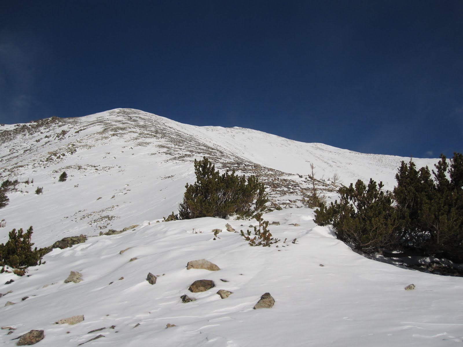
The way up to the ridge that leads to Esprit Point.
I felt great coming out of the trees. I did feel like I was farther than I really was. Getting to that ridge I had views of Shavano and Esprit and I realized that I was not nearly as close as I thought I was. When became strong and unrelenting from the time I topped that ridge until the time I left it hours later. Every now and again I would find myself with a minute or so of relief and I hoped it would let up eventually. It didn't. This has been my experience hiking above 13,000 ft. The top of Esprit would signify 4500 feet of elevation gain over about 3 miles. It had taken about 5 hours. Another hour and twenty minutes later I was sitting on top of Shavano and I knew that I would be calling it a day. Tabeguache Peak (14,155 ft) was less than a mile away but the thought of re-summiting Shavano to get back seemed too much this day. I enjoyed myself on the summit for about 15 minutes and started the journey back to the car.

Mount Shavano viewed from 13,300 ft. Almost 1000 vertical feet to go.
Climbing up Shavano's last pitch looking back on Esprit Point.
Summit!
I'll to come back for this one.
Mount Ouray again.
The Sawatch range!
The way back was just like the way up. Except that instead of staying between the two drainages I got myself nestled in the east drainage and let the snow slide me right down. I probably descended about 2000 vertical feet in under 5 minutes. Great fun. I essentially followed the drainage right out and ended up back on County Road 240 which is the road I came in on. I missed the trailhead by about 300 yards. Found my way back to car around 3:30 pm making it about a 9.5 hour round trip.

A look up the drainage well below snow level.
Last look at Shavano and Esprit before heading home.

I wish I could've tackled Tabeguache as well but a time commitment left me pressed to get home. I'm excited for summer to arrive to be able to hit these mountains without snow and with full access to the trailheads. I've loved hiking in the winter and spring but each season has it's own element of excitement that it brings.

Notes to Self:
-weigh my pack before leaving next time (I'm curious as to how much weight is on my back)
-be thorough with sunscreen (the under part of my nose got it bad, but that's it)

Monday, April 18, 2011

Mount Belford 4/6/2011

Total Mileage: ~16 miles
Total Elevation: ~5000 ft.
Starting Point: 4 miles below the Missouri Gulch Trailhead
Group: Solo
(click to enlarge photos)


I had large aspirations when this day started. When it ended, I was glad to not be spending the night in my car out of necessity. I had awoken very early to get a good start on this hike. I had figured that the trailhead was not going to be accessible from the recent reports I had read. I wanted to get as close to the TH as I could. As it would turn out, I was a bit over zealous in my car's abilities and started my day stuck in the snow pretty deep about 4 miles from the TH. It was 5:30am and it was still dark. I spent 30 minutes digging my car out with my ice axe to no avail. At about 6 am I convinced myself to proceed with the hike and get my car out later.

The original plan was to climb Mount Belford first, then traverse over to Oxford and at that point evaluate conditions with hopes of climbing Missouri Mountain as well. From the get-go I knew that Missouri would not happen. Not with the added time it was now going to take me to get my car unstuck after my hike. I was still optimistic and thought that today was going to be a two mountain minimum. It was an uneventful 4 mile start to the beginning of the Missouri Gulch TH.


I cached one bottle of Gatorade and one bottle of water here at the TH knowing I wouldn't need it until later. The beginning of the trail starts getting steep right away as it weaves it's way up through the forest. I wore only my hiking boots because the snow was just soft enough for good purchasing but not too soft that I would fall though it. I had Microspikes and snowshoes with me that I would use later on. On the descent of this same section of trail I would find that even with snowshoes on I was sinking 6-8 inches with every step. The warm afternoon made the snow very squishy.

Before I emerged from the trees the snow began to give way and the postholing commenced. I strapped on my snowshoes and continued upward and onward. While reviewing the route for this hike I remember reading about a stream crossing followed by an old abandoned log cabin along the trail. I thought it strange at many points up the trail that I had not passed this area. I never saw the log cabin on the way up or the way down. I have an inkling as to where I missed the trail but it will be fun to return here this summer and see where I went off. Directionally, I knew where I had to go so route finding was not difficult in spite of losing the trail. Snowshoes proved to be quite useful. A tough slog through the remaining forested area and I was out in the open.

A look behind.

Belford dead ahead

Looking at hiker's left.
Two strikes against me now. Getting the car stuck and losing the trail. I didn't think much of it though because I had already decided that not doing Missouri would save me oodles of time. With Belford in sight it was straight ahead to the part that I had been dreading. The shoulder up Belford leading to the summit. Mount Belford is not rated as a very difficult mountain to climb however, the final one mile to the top covers 2300' of elevation. It is long, it is relentless, it is never-ending, and it is tough. In addition to this I had been feeling especially weak all morning long. I can only attribute this to simply having an "off" day. I cached the snowshoes at the bottom of the shoulder and began my ascent up. It took me 2.5 hours to climb that shoulder. I felt the need to stop very frequently to catch my breath. When I was moving it was not much faster than a crawl. I made to the top of the shoulder which put me just below the summit of Belford. Reaching this saddle I had great views of many beautiful mountains surrounding the area. Contrasted with the dreary view of the remaining route.

The way up (summit not visible)
Before too long I was on top and looking at a lot of familiar peaks.


It was around 2ish when I made the summit and I was disgusted at such awful time I had made getting there. I knew there was no way Oxford was in the cards that day. Also, the summit pictures when compared to the pictures in the open basin show a very different weather forecast. I was happy to have one more mountain under my belt and decided to claim it as a victory and head home. I glissaded most of the way down and was down the shoulder in about 14 minutes. I fetched my snowshoes and headed back down trying to see if I could find the trail on the way down. Before that I ran into these sneaky buggars.

Discovered in the late 1700's these strange birds are thought by scholars to be some kind of hybrid of the native warblers and mountain chickens. They are also bred for their skills and magic.

I searched long and hard for any semblance of a trail and came up empty handed. I went down slightly deviating from the way I had come up. I found no trail but instead a tree that looked like it had no place being where it was.

Either a sycamore or a maple spruce. Or any number of other possibilities.
I ended up being able to swing back a bit to find my tracks up. I followed them down to where the trail clearly picked back up and looked around very confused at where I had gone amiss. I shrugged my shoulders (I literally did this) and decided that I'd find out this summer the answers to my questions. I was back to the TH in no time and picked up my stashed liquids and headed down to the next big task ahead of me. I told myself I'd try for 45 minutes and then If I wasn't successful getting my car out I'd call a towing service. This is how my day ended.


I drove out around 7ish and still had a bit more daylight left. I stopped in Buena Vista for a burger and headed back to CO Springs.

Notes to Self:
- Snowshoes aren't the devil after all
- trails are for suckers
- cell phone coverage saved my butt so I should probably switch to Verizon if I'm going to continue hiking.

Wednesday, March 23, 2011

Little Bear Peak 3/21/2011

Total Mileage: ~13 miles
Total Elevation Gain: ~6200 feet
Starting Point: Lake Como Road
Total Time: 13.5 hours


From Lake Como 11,750 ft.

Alright, here's the situation. My wife's friend came to visit for a short vacation. I got keys to the brand new Porsche....and headed to Little Bear Peak. Except it wasn't a Porsche, it was a Subaru. And it wasn't new, it's an '08.

A typical hike for me has always involved waking up quite early and driving 2-3 hours to arrive at the trailhead around 6ish. I devised a new strategy for Little Bear because I wanted to get as early a start as possible. I decided I would just drive there at night and sleep in my car at the trailhead. So, I arrived at the Lake Como Road at about 11:15 pm the night before and set my alarm for 4:45 am. The Chateau Subareaù was very accommodating and I was treated to a continental breakfast of apple strudel and Sunny D! A weird side note, when I arrived I noticed the clock in my car said 11:15 pm and my phone said 10:15 pm as did my watch (which sets the time automatically). So, I'm not sure if there is a time difference between Colorado Springs and Blanca, CO or not but I went with it. This sort of sucked because that would mean I would lose an hour coming home. My phone and watch stayed behind one hour during the whole trip.

I ate my delectable breakfast and was geared up by 5:00 am to get going. There was a faint glow over the mountain ridge to the East but it would be a solid hour before morning light would become available. I had been walking for about 10 minutes when I realized I forgot my camera in the car. I hate turning around but I reasoned that if I did, not only would I have photographic evidence of this adventure, I would also get another bite of strudel and wash it down with a little more Sunny D. New starting time would be 5:30 am.

The first leg of this hike would be a 5.25 mile long "road" to Lake Como. This road is not accessible, even in the summer, by anything but an ATV or a heavily modified 4x4 vehicle (or feet). I found a cool video on youtube that shows a bunch of cars going up the road. The video calls it the Blanca Peak road. Same difference. Blanca peak is an adjacent peak that is accessible by this same road. I came these abandoned log cabins maybe half way to Lake Como and looked up to see my first glimpse of Little Bear Peak.

Little Bear center and in the distance.
Snow wasn't present until about this point. It became deeper and every now and again I would drop through to about my knees. This wouldn't prove to be a problem until after I reached Lake Como. Reaching the lake, I stopped to re energize and soak in some views the surrounding peaks.


From Lake Como 11,750 ft.
 

The plan is to come back in the summer and hike these two.
 The next leg is to find and climb a north facing gully 600 feet to gain the west ridge leading up to Little Bear. Just to get to the bottom of the gully took me about 90 minutes when it should have taken about 20-25. After rounding the north end of Lake Como I reentered the trees and every step was exhausting. For about a half mile I would sink to my knees or deeper into the snow. The top 3 inches were crusted over but underneath was pretty soft. I've reconsidered my position on snowshoes. One situation in particular had me crawling on my hands and knees because I found I wouldn't sink and it was faster than the alternative. Not only did I waste valuable time here but also valuable energy. I'm glad I was the only one on the mountain because I was getting mad. Audibly mad. I reached the bottom of the gully at 9:45 am and took some time to refuel and calculate the best route up the gully.

From the bottom of the gully. Only the bottom half is visible.
As I ascended I glanced far to my right and I saw another set of tracks that had ascended the gully before me. I figured those tracks would provide more compact snow to climb on so as soon as I could I turned hard right to get onto these tracks. Life got easier from there.


Halfway up the 600 ft gully looking down.

And then looking up.
I reached the top of the gully at 10:45 am. A solid hour that definitely would have taken longer without the aid of those previous tracks. At the top there is 12,900 ft. point that blocks the view of Little Bear. Some go up and over, but I decided to go around. Once around the ridge of that point I could see the rest of the route to the summit.

Remaining route.
Looking at the distance from where I was to the base of the "Hourglass" I had considered calling it a day. Which would have made it the 57th time I had considered throwing in the towel that day. Since I was enjoying myself, I figured I would hike, however slowly, until around 3 pm. The weather was great. The coldest that I saw that day was 30 F and that was on the summit. The temperature hovered around 40 F most of the day. I had plenty of food and liquids. Sitting there contemplating an early return I realized I wasn't even that tired. I was afraid of getting tired, which is a lame reason to turn around. Especially with my wife being entertained by her guest for the weekend I decided to press on and set my turn around time for 3 pm regardless of where I was.

From the above picture it shows that I would cross a snowfield to a patch of rocks and then across another snowfield to more rocks until the "hourglass." This was an exhausting process. I stopped frequently but only for short amounts of time. I began to think of all the people around the world who are just as exhausted as I am but they're running like gerbils on treadmills. I get to be exhausted in the middle of snow capped mountains and lakes on a sunny day. When it's my turn to be a gerbil, I get done with a solid run and I head to the drinking fountain and think to myself, "That sucked." In contrast, when I finish hiking across a snowfield, I land on a patch of dry rocks, bust open a Gatorade and with the same feeling of exhaustion I think to myself, "That was awesome!"

Before too long (2.5 hours) I arrived at the base of the Hourglass. I ran into a familiar set of tracks heading straight up. I followed them down with my eyes to see that whoever these tracks belong to had started way down in the basin. They were very likely the same tracks that aided me up the north facing gully earlier on. From the base of the hourglass I snapped a picture looking back on what I had accomplished.


I should take a second here to give some background on this "hourglass" I keep mentioning. If you're my mom or my wife or anyone that will scare my mom or wife by talking about this you should skip the next paragraph.

Little Bear is one of Colorado's toughest 14ers and this is due to the last gully that must be ascended. The name of the gully is the "hourglass." It is a large funnel that is quite steep and full of loose rock. People have died climbing this route and maybe the greatest danger is from climbers above you knocking down loose rock into this natural funnel. Hiking this route in March provided a few safety precautions that a summer summit would deny. First, being alone is an advantage in my opinion. Knowing that nobody is above you or below helps to make this a safer endeavor. Second, when the hourglass is filled with snow/ice it provides purchase points that create greater stability. This is assuming that the climber has appropriate gear. I would use the butt end of my ice axe to create a six inch hole in the snow/ice before placing my foot in it. Doing this at every step is tedious but ensures that when I put my foot in the snow and commit to that step it will hold. I wore microspikes and it was sufficient. Crampons would be ideal. As I gained more elevation in this final gully below the summit I did have the opportunity to shift to dry rock to continue. I was so much more comfortable on the snow and ice that the rest of my route was determined by where I could remain in it. The tracks that I mentioned earlier chose a route on dry rock so I could only follow those tracks for a short while. From the base I got a picture looking up but it hardly does it justice.

The tracks are visible here.
It took me about an hour and 20 minutes from the base to the summit. I was pooped. I scarfed down a Clif Bar and 20 oz. of water, took some photos and made haste back down the mountain.
Summit shots:


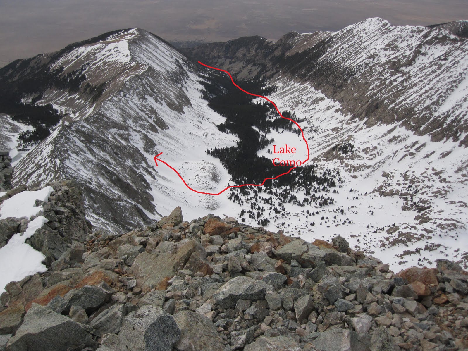
From the summit looking down on Lake Como.


Looking down the way I came up.

Yours truly!

I made the summit at 2:35 and left the summit at 2:40. I was back down to the base of the Hourglass at 2:49 pm. I used my ice axe as a brake for a controlled glissade down the Hourglass. This is another advantage of doing Little Bear in the snow. The descent isn't as dangerous in my opinion. I cruised back across the west ridge to the top of the 600 ft. north facing gully. I glissaded down that gully as well in about 6 minutes.

I was dreading the postholing nightmare awaiting me at the bottom of the gully back to the south end of Lake Como. I took a little detour from the way up but it turned out to be almost as bad. For every two steps on top of snow I'd have to take five steps waist deep in snow. I was ecstatic to reach the road where I would only sink down to mid-calf. It was 4:45 pm when I reached the Lake Como road. It was a mindless jaunt to the car where I arrived at 6:45 pm.

I had waited until arriving at the car to really assess what I had accomplished. I think Ed Viesturs (famous mountaineer) was the one who said "Getting to the summit is optional. Getting back down is mandatory." Once I was down, I was elated to have completed one of the most difficult and probably the most dangerous 14er in Colorado. I ran a half marathon a few years back and I can say unequivocally this was harder. Physically and mentally I had been pushed nearly to my limits. My only regret is that I wish I had completed this hike one day previous to be able to claim a calender winter summit of this mountain. A big thanks to my wife for allowing me to pursue this hike and this hobby in general. She is the greatest!

Notes to Self:
-Sleeping in cars sucks
-buy more Clif Bars

Sunday, March 13, 2011

Mount Cameron, Mount Lincoln, and Mount Bross 3/12/2011

Total Mileage: ~12 miles
Total Elevation: ~3000 feet
Starting Point: Paris Mill (3 miles south of Kite Lake)


Mount Lincoln summit viewed from the summit of Mount Cameron.

Redemption!

Almost one month ago I came to Kite Lake to climb the four 14,ooo foot mountains surrounding it. I made it to the top of Mount Democrat and turned back, leaving the other three for another day. Last Saturday was that day and I couldn't have asked for more cooperative weather in March. The approach was identical up until Kite Lake. I brought along my buddy Eric who climbed Grays, Torreys, Castle and Conundrum with me back in September. We started from Paris Mill at 6:30am. At Kite lake I made some adjustments to my route from my previous experience up Democrat. No trails are readily visible but everything is blanketed in snow so erosion isn't really a concern. The goal was to find the most gradual path through and out of the basin. This go-around I stayed much higher on a ridge that I had previously left alone on the Democrat hike.


The red here was my previous route one month earlier and the blue arrows give an idea of how I changed things up. If I did this hike a third time I'd stick to blue route as closely as I could. I felt we really moved through the basin quickly and efficiently.

Still in the basin looking back on Kite Lake Trailhead from the the ridge.


Finding a route out of the basin. Followed a snowshoe path made a hiker a bit ahead of us.


Once out of the basin we had to make it to the Democrat-Cameron saddle. From the saddle the remaining route would simply be following ridges of mountains leading to their summits. From the top of the basin we paused a bit to determine if we would follow the hikers path or look for a better option.

This guy really went for it. We decided on another route to the saddle.


From the same point where the above picture was taken we glanced to our left and saw a much more gradual approach to the saddle.


 Route out of the basin as viewed descending Mount Bross.

From the saddle between Democrat and Cameron it was as simple as following a straight line to the summit. A long, steep, straight line. We arrived at the saddle at around 10:15am. We made great time to Cameron and on to Lincoln summiting Lincoln at around 11:30am.

Just shy of the Mount Cameron summit.

On top of Mount Cameron 14,238 ft. Mount Democrat is directly behind me (green).

15 minutes later on Mount Lincoln's summit. It was cold.

Seen from Mount Lincoln.

Seen from Mount Lincoln.

From Lincoln we descended and started to make our way to Mount Bross. Wind picked up quite a bit and it felt like the temperature dropped 15 degrees in as many minutes. Made it to the top and stayed long enough to document with a photo.

Mount Bross summit 14,172 ft.

The route down was clearly marked but consisted of a lot of loose scree. It was not a fast descent by any means. It actually felt like it took forever to get off Bross. The wind was getting wild on top of Bross and didn't let up until we had descended about 500 vertical feet.  We ended up back at Kite Lake just as some campers were arriving. Eric and I were joined by a fellow hiker and climber named Luke towards the beginning of the hike. He tagged along with us the entire way and it was great company. The more the merrier. From Kite Lake it was an easy 3 miles back to the car. We ran into this cuddly fella on the way back.

My first Porcupine spotting ever!

Great fun. Great company. Can't wait until the next one.

Notes to Self:

- if you realize that you've forgotten sunscreen and you're only 100 feet from your car, turn back and put some on. It's not nearly as inconvenient as not doing so.

Saturday, February 19, 2011

Mount Democrat 2/18/2011

Total Mileage: ~9 miles
Total Elevation: ~3000 feet
Starting Point: Paris Mill (3 miles south of Kite Lake)


Mount Democrat. This picture was taken from 14ers.com since I didn't get a chance to make many pics.

I had a 4 day weekend and nothing to do so I started to check out if the weather would allow for a jaunt to the top of a mountain. Weather reports for the town of Alma, CO predicted "partly sunny with a high near 17 degrees." That was good enough for me to pack up the gear and head out to the mountains Friday morning.

I left my home in Colorado Springs at 5:20 am and arrived in Alma at around 7:05 am. Kite Lake is the beginning of the trailhead which is 6 miles NW of Alma. With winter conditions, the last 3 miles of the road to Kite Lake is closed. An old dilapidated mill called Paris Mill is as far as I got in my car which stuck me with an additional 6 miles round-trip. I started off from Paris Mill at about 7:20 am. The road was wind swept leaving portions bare and other portions with knee deep snow. No snowshoes for this trip and that was intentional. I haven't convinced myself that I need them yet. The added bulk around my feet doesn't sit well with me. I do wear microspikes and gaiters and that was definitely sufficient for me. So, of course, there are times when I'm walking and drop 12-18 inches into the snow. It just added to the manly-ness of the overall experience.

I arrived at Kite Lake. I only knew this because I saw signs that said so. The basin that Kite Lake sits in was one big blanket of snow. So I should pause and say right now that this hike was only a partial success. I had intended to climb four separate mountains. Democrat, Cameron, Lincoln, and Bross. This foursome is commonly referred to as Decalibron. The name is derived from using the first two letters of each peak. I've never known where the "N" comes from on the end though. I just assume it's to make it sound cool. I took too long to get to the top of Democrat and I was quite exhausted so I'll have to go back to climb the other three.

Doesn't do much justice but this is Cameron dead ahead from Kite Lake. I thought I'd be able to take more pictures from up top.

I don't have many pictures because my camera ran out of battery before I got to the summit of Democrat. The route always reminds me of a baseball diamond with Kite Lake being home plate. Doing the standard route you'd run the bases backwards. The saddle between Democrat and Cameron being third base. You'd summit Cameron right before you hit second base which is Lincoln. Bross is first base and then back down to Kite Lake to complete the loop. Not an exact diamond but roughly so.


From Kite Lake I saw no trail into the basin. Every so often I could look ahead and see the upper two feet of a trail marker. I was able to use these to get through most of the basin.

I found this sign particularly useful.
I turned to climb out of the basin a little early and ended up really exerting myself. At times I found myself in some Class 3 situations which led to many more rests than are typical. The snow in the basin was consistently ankle deep and there were times where I would sink to my knees. This also contributed to a very long and arduous day. In spite of this I really enjoyed myself and I've always found that the more difficult a task becomes the more rewarding it becomes to complete it. Once out of the basin (but below the Dem-Cam saddle) winds picked up and cold ensued.

I added the red to show roughly how I manuevered through the basin and then out. The dotted just means I was behind the ridge. I'm just bad at using paint. Democrat actually isn't in this picture.

I'm no expert but I feel that continuous movement, no matter how slow, helps to alleviate the cold weather. So I continued up slowly. On the way up I never really arrived at the saddle. Having deviated from the trail, I ended up on the Democrat ridge about 150 feet above the saddle. From there it was just up and up and up. Winds were at their worst at this point with nowhere to escape them. It is only about 1/2 mile from the saddle to the summit of Democrat but it was a very long 1/2 mile. Mileage isn't as descriptive as knowing the terrain over which that mileage covers. At the summit I sat down and tried to take a picture and that's when I found out my camera had run out of battery. While I was on the summit I had a chance to look down at my boots and I noticed that my microspikes were inside out. I was contemplating not sharing this out of sheer embarrassment. I reversed my spikes and found myself reflecting on how many times I slipped or lost my footing on the way up. The small thermometer I have on my backpack was reading zero degrees but I think the wind made it even colder. I looked at the time and it was 12:30 pm. I could not believe it took me 5 hours to get there. I looked around and the clouds were appearing more and more ominous. I thought to myself that I'd get to the saddle and then decide whether I would climb up to Cameron or not. Secretly I knew that I'd be going back down to Kite Lake though. Arriving at the saddle I could make out a trail going back down to the basin and committed to return home for the day. As I had anticipated, the wind got better and the air got warmer as I dropped in elevation. I was on the standard trail for most of the way down which was nice. There were even a few parts that I could slide down on the ice/snow. Going down went by fast and I was back at Kite Lake before I knew it. My thermometer read a toasty 20 degrees. Then it was a three mile hike back to the car. It started to snow on my way back to the car and I turned around to see Mount Cameron obscured by copious amounts of fog. I was glad I wasn't up there. Reached the car at 3:40 pm and I was back home before six. I never saw a single person from the time I left Alma until I drove back into town.

I really hate turning around without accomplishing my goal. I think I made the right choice and I'm looking forward to going back. It will be nice to be able to cut out the Democrat leg of the hike for next time. I hiked Humboldt back in November but I consider Democrat to be my first real winter 14er summit. I was wearing trail runners on Humboldt for crying out loud. No way a winter hike should count as a winter hike if I was wearing trail runners.

Notes to Self:
-  consider snowshoes
-  hiking takes much longer in snow
-  because I will likely be hiking as long as I'm physically capable there is never a rush to "go for it" when I get that feeling that I should call it a day