Total Mileage: about 27 miles
Total Elevation Gain: ~11,200 feet
Starting Point: Needleton
Total Time: 21.5 hours of hiking over 3 days
Party: Myself, Eric B., Brandon J., Todd H., Ron R., Tim H., Dan B., and 4 other from Utah I didn't know very well and didn't stay there very long either.
 |
| The beautiful Chicago Basin! Windom peak is left of center. |
This is a hiking adventure that could easily be (and probably is) the highlight of anyone's life, let alone the summer. The Chicago Basin is located in the heart of the San Juan mountain range in southern Colorado. There are four 14ers that are within hiking distance from this basin. Mount Eolus, North Eolus, Windom Peak, and Sunlight Peak. The goal, of course was all four. Weather would change our plans.
We would start from the town of Durango. To arrive at the Needlton Trailhead one must catch a train that goes between Durango and Silverton. Needleton is about 30 miles north of Durango and there is really no other way of arriving there. The train departed at 9am on Friday morning and dropped us off at the trailhead around 11:30am.
 |
| Loading our packs in the cargo car of the train before departing. |
 |
| Overlooking the Las Animas River en route to Needleton. |
 |
| The Needleton drop-off. We would return here in 3 days. |
 |
| This suspension bridge marks the beginning of the trail to the Chicago basin and crosses the Las Animas River. |
With 11 people in our party we made our initial ascent into the Chicago basin. I started it off with a little hiccup. About one quarter mile into the hike I realized I had left my trekking poles at the trailhead. I turned around and made it about half way back and saw a woman who had picked them up for me. Not a huge speed bump but it did put me at the back of the group.
From Needleton it's six miles to the Chicago Basin area. En route we would gain about 2800 feet of elevation. With my pack weighing about 45 lbs I felt like this might be the crux of the entire route.
 |
| We experienced a bit of moisture on our way up to Chicago Basin. |
It took about four hours to make my way to where we would set up camp. Good company the entire way made it easier to forget that I had 45 lbs strapped to my back. We found a great group campsite and quickly got tents set up for the night.
 |
| Camping at 11,100 feet in the Chicago basin. |
Our goal for the morning was going to be Windom peak. We knew the weather wasn't going to be the greatest so we'd try for the easiest of the four peaks first. I think we decided on a 5 o'clock start time. I could tell that not everyone was crazy about the early start time but it would give us the best shot at summit success.
I probably haven't slept so bad in my entire life than that night (and the subsequent night as well). The ground was cold and I didn't bring a pad to lay down underneath me. I couldn't really tell if I was ever sleeping or not. Some kind of rest must have happened or I think I would have been dead tired the next day.
In the dark the next morning all 11 of us set out for Windom Peak. The fog was hovering at about 12000 feet. So we started with good visibility that dwindled as we climbed higher.
 |
| Taken on the way down this shot shows the fog just hovering. Our camp is in the lower right corner here. |
We all arrived at Twin Lakes which is about 1400 vertical feet above the Chicago Basin and our campsite. At this particular time it was also located in the heart of this increasing fog. We convened and discussed our next strategy. We all agreed to proceed to Windom under little visibility. We left in small groups at slightly different times.
 |
| Gathering at Twin Lakes to discuss our next move. |
 |
| Eric B. contemplating the Polar Bear Challenge! |
 |
| First group heads into the void. Windom is over there somewhere. |
By way of explanation, the route to Windom is similar to the route of Sunlight Peak as well. Sunlight is another 14er located about 1/2 mile north of Windom. A little ways above Twin lakes I started to question whether or not we were on the right track towards Windom. I had a hunch that we had left the route to Windom and were heading towards Sunlight Peak instead. It would have only required a small course correction at the time I realized this. Unfortunately, I was in the rear of the group at this time. The wind was picking up and communication to the other groups ahead of us was impossible. Not too much further we all stopped and I made by recommendation that we reconsider our route. Some there pulled out maps and began to evaluate our current position. Through the next 3 minutes of conversation I was convinced that I was wrong and that we were heading towards our intended destination. We pressed on. At about 13,400 feet I had changed my mind yet again with more conviction that we had, indeed, not followed the right path. I believed that we were actually cliimbing Sunlight and not Windom. The tops of the peaks could not be seen due to fog and there was little means to use landmarks to navigate. Again, I was lagging behind and could not communicate this idea to anyone.
Soon after I was startled by loud thunder that seemed to have come out of nowhere. This stopped the party and allowed me to catch up. I didn't see lightning but others did and described the lightning as having knocked a large boulder loose not far from where we were standing. They were discussing calling it a day. I said we were on the wrong peak anyways so we might as well. A few disagreed with me, but after pulling out my GPS there was no question we had gone wrong. (Yes, I had a GPS and yes, I should have used it to begin with.)
So back to camp we went. Arriving at camp around 10 am. It was a fun four hour excursion that didn't net us a summit. We got as high as about 13,500 before turning around. The four-man Utah group in our party had had enough apparently. They decided that they would be catching that day's train back to Durango and heading back to Utah that night. It's hard to not feel a little demoralized with the morning's events and part of the group calling it quits. I'd be lying if I said I wasn't a little jealous that they'd be sleeping in warm beds that night and I would be tossing and turning. They broke camp and left wishing us luck for an attempt the next day.
As it turned out the next attempt up would be a little sooner than that. As the day went on, the weather turned worse. At around 2 pm we got a snow shower at camp that lasted a little more than an hour and left a 2-3 inch blanket of snow all around us. Then, at around 3:30pm the clouds parted and the sun finally broke through unimpeded. The storm had broke and we were left with a bluebird sky! So what now?
I was standing with the rest of the group and said, "If anyone else wants to head up right now with me, I'm willing to give it a go." Brandon almost immediately volunteered as if he was dying of boredom. We agreed to get going and Eric joined us as well. I thought that the timing was such that we would arrive back at camp around dark, maybe a little after. We decided that we would leave Windom for the next day and attempt Mount Eolus that evening. It's no further than Windom would have been. Instead of going right at Twin Lakes you just go left basically. Around 4 pm we were off.
About one hour later we arrived at Twin Lakes for the second time that day. But instead of seeing this:
 |
| Twin Lakes at 7 am. |
We saw this:
A much different view at 5pm.
So we took a short break and continued climbing towards Eolus. There is a feature commonly referred to as "The Catwalk" on Mount Eolus. It is a narrow walkway with steep exposure on either side that one must walk across to summit the mountain. We were a little concerned with the recent snowfall what the conditions there would provide. We had North Eolus as a back-up plan if the Catwalk proved too dangerous.
 |
| Heading up Eolus in 12-18 inches of snow we weren't planning on. |
 |
| Windom behind us dead center. |
We were heading towards the saddle that connects Eolus to North Eolus. from there we would make a determination to attempt the Catwalk or not. The next picture show our route (roughly) from Twin Lakes to the saddle.
 |
| Taken from near the top of Windom the next day. |
We arrived on the saddle and decide to go towards Eolus and the Catwalk until we felt uncomfortable. It didn't take long for that to happen.
 |
| Eric is waiting for Brandon and me to catch up. The Catwalk is below where Eric is sitting. |
 |
| We fell victim to good judgement and retreated back towards North Eolus. |
Eolus wasn't in the cards that evening. When the above pictures were shot we were about 30 minutes from the sun setting. We wanted to summit something at the very least. From the saddle between the two peaks it only took about 15 minutes for us to be on top of North Eolus.
 |
| North Eolus 14,039 feet! |
Spectacular views from North Eolus right as the sun had set.
 |
| Wilson group of 14ers far in the distance. |
 |
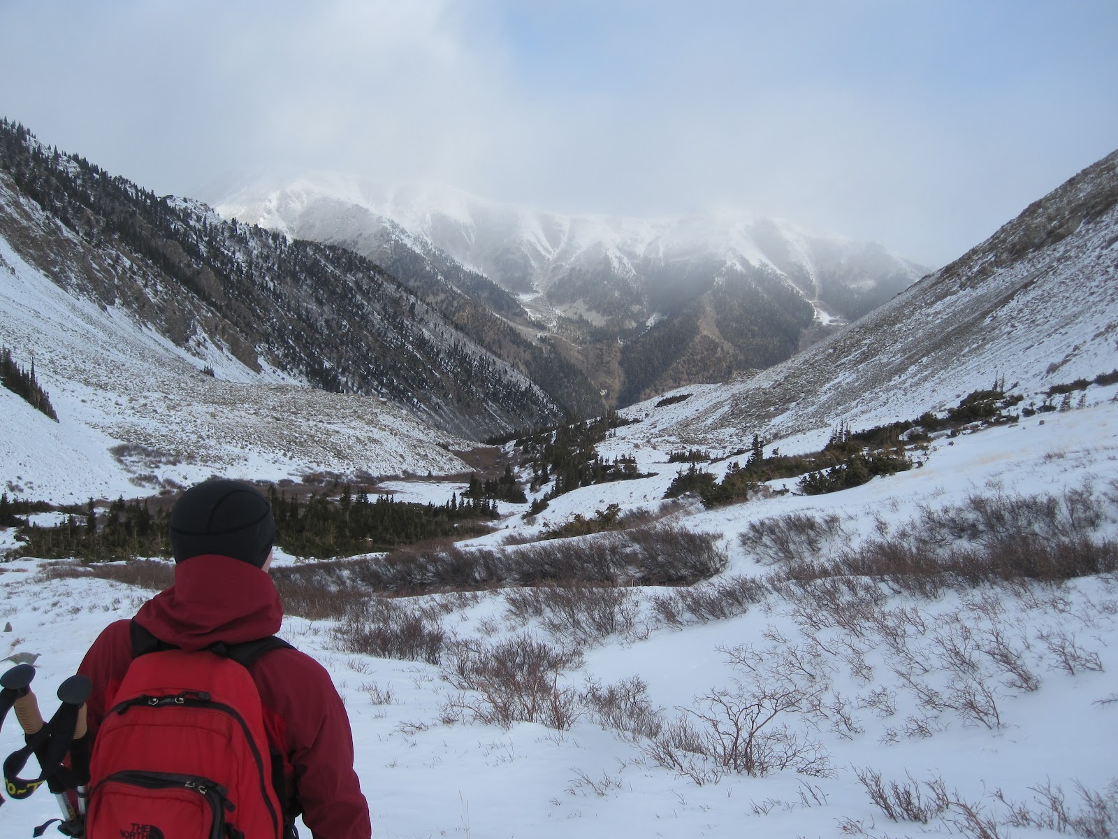
| Heading back down to camp. |
From the top of North Eolus we could see easily how far off we were that morning.
 |
| We had turned around at point "B" many of us thinking we were at point "A". |
This goes to show how easy it can be to lose your ability to navigate under less than ideal conditions.
We made short work of the way down. It was officially dark when we arrived at Twin lakes. We donned headlamps and continued down the trail to camp. From that distance we could see the campfire and headlamps those of our party that chose to stay.
It was around 9:30 pm when we rolled into camp. I got warm around the fire and tried to dry out some gear knowing we'd be marching up that trail again in about 7 hours.
The next night was worse than the first one for me. I left my tent around 4 am and got the fire going. Everyone else was asleep. I figured if I can't sleep, why be cold and awake when I can be warm and awake. Plus everyone else would appreciate a rip-roaring fire when they get up. At around 5:15 am I was the camp's wake-up call. We ate some breakfast, refilled water, and got going. We had clear star-filled skies and an early start on this our second attempt of Windom Peak.
No wrong turns this time. I arrived at Twin Lakes much behind the rest of the group. I had left about 8 minutes after the last person from camp because I had misplaced my GPS device. Once I found it, I made it about half way to Twin lakes before nature called quite abruptly. Having taken care of business I found, ten minutes later, nature wasn't done. Once nature and I had settled our differences I hightailed it to Twin lakes. I got there and many were already rested and ready to continue onward. They did, and I waited a bit to rest up.
 |
| Heading up Windom just above Twin lakes. |
It's nice being able to see where you're going. It was slow going for sure but I held a steady pace and before long we were all standing on the summit of Windom Peak.
 |
| We were glad we waited out the poor weather! |
 |
| Yours truly at 14,089 feet! 28th 14er under my belt! |
 |
| Sitting on top of the Chicago basin! |
 |
| Arrow peak and Vestal peak are the prominent mountains to the left. They aren't 14ers but they are very impressive mountains |
From the top of the Windom Peak our next goal was to catch the train back to Durango. Of course, this required us to break camp first. The way down offered some fun glissading for many. I prefer plunge-stepping myself and Todd caught some sweet video of me plunging about 800 feet down off Windom. Still waiting on that though. You'll just have to trust that it was awesome.
I had run out of water so I refilled at Twin Lakes. We broke camp quickly and from there it was a 6 mile hike back to the suspension bridge where the train would be picking us up. We had a little less than 3 hours to get there. If you miss the train there is no other way out. Well, I suppose there's always another way out. Just not a way that doesn't require 30 miles of hiking as the minimum energy expenditure to get out. A few of us were pretty fatigued at this point but felt confident we would all make it in time.
 |
| Hiking out of the Chicago Basin |
We all made it to the train. The last of us made it with only about 10-12 minutes to spare. Cutting it pretty close I'd say. We boarded the train and 3 hours later we were eating Bacon Slamburgers at Durango's local Denny's!! Chicago Basin is a fantastic area that I will be looking forward to visiting again!