Saturday, February 25, 2012

Mount Sherman 2/2/2012

Total Mileage: ~10 miles
Elevation gained: ~3000 feet
Party: solo
Starting point: .75 miles before the Leavick site

Mount Sherman 14,036 feet (summit not visible) 
It was time to get out again. The forecast wasn't ideal but it rarely is this time of year here. It was about 5:30 am when I arrived at the trailhead. No other cars had arrived before me so I had no idea who I might be sharing this mountain with today. I got suited up and headed up the snowdrifted road. I may have been able to  get another .5 miles up the road but better judgement got the better of me. The snow was about 8-10 inches deep where I stopped. It didn't take long before I donned my snowshoes. Made such a huge difference in energy expenditure.

There's a lot of people who claim Sherman as one of the most boring 14ers in all Colorado. I think it helps to climb it in winter covered in 1-2 feet of snow. It really was awesome and quite challenging for me. I made it to the Leavick site fairly quickly which is the normal summer trailhead for most people.

This area is rich with mining history.  That's the extent of my knowledge though.

A lot of signs warning to keep out. Might be a secret fight club location.
About a mile in it became light enough to turn off my headlamp. The sun never really came out that day. It tried to all day but the fog cover just hovered in the wrong place all day long. It still was quite scenic but I would have loved some unobstructed views.

From the Leavick site it's just up and up the road. Passing what remains of a once thriving mining operation.

You can see the wind picking up here and the sun trying to get though creating a kind of eerie scene.

The mountain ahead of me covered in clouds.

Further up the road this is another look back. 

Mining stuff.

This is the Hilltop Mine at ~13,000 feet. The wind hit a fever pitch right as I topped out at the mine.

White Ridge 13,684 feet shares a saddle with Sherman
Well, everything was manageable until I hit the Hilltop Mine shown above. The standard route gains the southwest ridge of Sherman via a saddle connecting it to Mount Sheridan. The entire saddle was obstructed by a huge snow cornice essentially making it impassable. To add to the difficulty the wind was rip-roaring and tearing through the area just below the saddle. I had determined that I was done and had actually started to turn around. I made one last look to assess any other way up. I spotted a line that I thought might work. It was fairly steep but I thought I might be protected by the wind so I figured I'd give it a shot.

The basic route I took up vs.....


Here is Mount Sheridan and the massive cornice obstructing access to the saddle from below. 
As I gained further up my chosen route it become clear that I had made the right choice. It also protected me from the wind until I gained the ridge. The route I had chosen carried me to the southwest ridge at about 13,700 feet. Once there I had to face even stronger winds but only had about 400 vertical feet to climb before I could start climbing back down. It wasn't the strongest winds I have ever been in but it was consistent and relentless.

This is most of the remaining route from where I gained the southwest ridge. 
Very cool snow crystal formations on the rock at just under 14,000 feet.

I guess you'll just have to trust me that this is me and that I am standing on the summit. 
No views from the summit which is always a bit of a disappointment. I was glad to be at the top and I was glad to start descending. I had purchased some new OR gloves that were a huge improvement from my old ones. My hands still froze instantly when I removed my gloves to take some of these pictures. But they didn't stay frozen for long like they used to. Once off the ridge I began to warm up quickly and made good time getting off the mountain. I had my axe with me so I could enjoy a controlled slide down the mountain. I was able to slide down about 1000 vertical feet total. A huge break for the knees.

It took me about 5 hours to summit and just over two hours to get back to the car. There was another car parked next to mine when I arrived back. But I never saw a single soul the entire day. I had the whole mountain to myself.

Quandary Peak 1/14/2012

Total Mileage: 6.75 miles
Elevation gain: ~3500 feet
Party: Eric W., Kurt W., myself
Starting point: Quandary trailhead

Quandary Peak 14,265 feet. 

Eric had called me with a few days notice. He told me his dad was in town and they wanted to hike a 14er and they invited me to tag along. I suggested Quandary and we met at the trailhead around 6:30 am. It was his dad's first 14,000 foot peak.

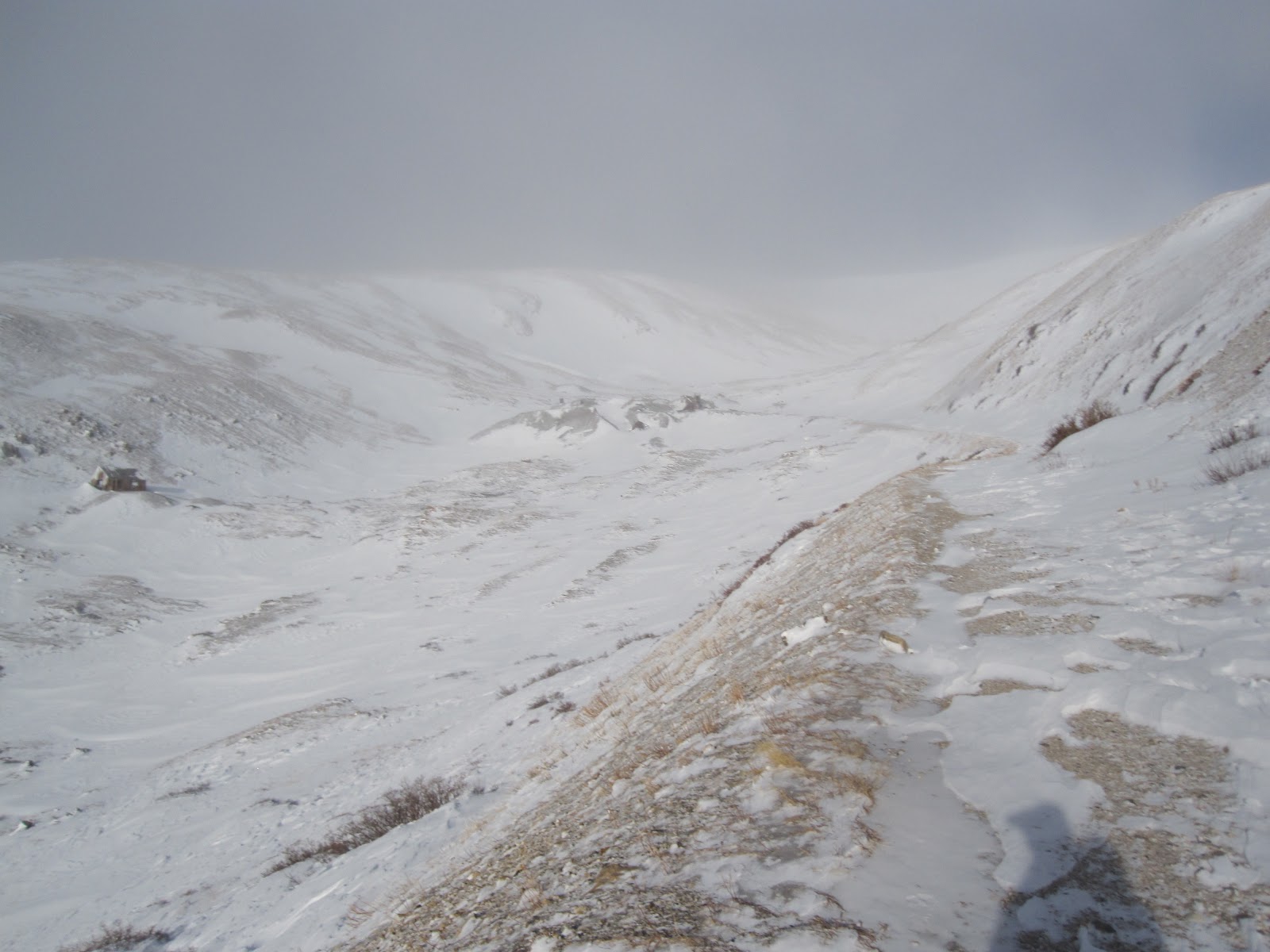
It was a beautiful Saturday so the trailhead was crowded. Even in winter. Because of all the traffic this peak gets there was a nicely laid trench to follow all the way up. So route finding wasn't necessary at all. We kept a slow and steady pace nearly the entire way.

We began in the dark, led by headlamp. Before too long the sky began to light up and we could turn our lamps off.

I'm upset at the blurriness here. It was a very pretty morning.
This hike is pretty short and sweet. Maybe a mile and a half in the trees and we were at timberline. From there it's just the long east ridge that we follow to the tippy top. The wind picked up a bit once on the ridge and continued to increase as we ascended.

A look behind after emerging from the trees.

Looking south this is North Star Mountain 13,614 feet

Looking towards the goal Eric and Kurt ahead of me.

From this point on, it's just one foot in front of the other. The scenery was absolutely gorgeous. The only downside was the wind that day. It really became quite frigid the higher we got. At the summit the fact that the sun was out seemed quite pointless. Removing gloves to take summit photos instantly froze my hands. Got a few summit shots and took a few for others as well.

About five feet below the summit offered sweet respite from the wind while we figured out who would take who's pics.

You can see the loose straps on my pack are perfectly parallel to the ground. Wind was intense.
I didn't bother to wait for my party. As soon as I was ready I bolted for lower ground and warmer temps. I got down a ways and shoved my hands down my pants to warm them up while I waited for my party to catch up. Once all appendages were warm we took a short break before heading the rest of the way to the car.

Eric (left) might be pooping here. 
It didn't take long before we had completely warmed up and were shedding layers as we descended further. There had to have been 40 people hiking the mountain that day. A very odd site to see in winter, even on Quandary. Quandary is a great mountain for beginners and I think Kurt had a great time. A few shots of the remaining descent:

Looking east on our descent off the ridge.

Parting shot of the mountain before it leaves our view.

In this close-up you can see hikers speckled on the ridge we were just on.

Last shot in the trees about 1 mile from the car. 
This was my first winter summit of the season and I had a great time with great company. We decided to head up to Breckenridge just 8 miles north for a bite to eat before making our respective trips back to Denver and Colorado Springs. My only regret was not bringing my balaclava. My face got pretty cold and I think that could have kept me a bit more comfortable during the colder times.