Roundtrip Elevation: 10,800 ft.
Starting point: Mount Princeton Trailhead

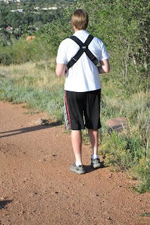
I left my home in Colorado Springs at 4:30am and set out for the Mount Princeton trailhead. I arrived at 6:30am and began the trip up. At the trailhead you may continue by car up the 4x4 road for 3-4 more miles. There are various parking spots but the road is very narrow and turning around is very difficult. Not trusting my car entirely I began my hike from the trailhead and hiked the 4x4 road by foot. This added a considerable amount of mileage to the trip. I didn't mind this mileage on the way up. I had underestimated the amount of water that I needed and on the way down I was wishing I could be done.
There comes a point where you must leave the 4x4 road and follow a foot trail the rest of the way to the summit. Right at treeline the trail creeps up and this is where the real hiking begins.
 |
| Looking east, standing above the 4x4 road on the foot trail leading to the summit. |
A short ridge quickly appears and once above that ridge Mount Princeton comes into full view.

Another picture (not taken by me) shows the general route I took to the summit.

Upon reaching the saddle a great view of Mount Antero is seen. This is another Colorado 14er.

Only about a mile left but the last mile is always the hardest for me. Usually because I'm at 13,000 feet elevation and leapfrogging over talus with virtually no trail. This is also the most rewarding part of climbing for me as well. Just before the summit I encountered this little reminder of how important it is pay attention to the conditions on the mountain.
 |
| Makes you want to keep on hiking right? |
The summit was pretty awesome. I stayed on top for about 30 minutes. I had a little phone reception so I updated my Facebook status, took a few pictures and then began my decent.
 |
| A view of Mount Antero to the south from the summit of Mount Princeton 14,197 ft. |
The decent proved more difficult than I had thought it to be. For much of the beginning of the decent I wasn't moving much faster than when I was going up. I wore trail shoes and in retrospect I would have brought hiking boots for that type of terrain. I have little chicken ankles that have a long history getting sprained. I had a few close calls but eventually I made it down unscathed.
I made back to the car around 3:00pm so all in all it took about 8.5 hours. A lot longer than what I thought it would take. At the car I was more thirsty than I can ever remember being in my life. Kind of a weird feeling. I found a gas station and guzzled down two bottles of water and a Powerade. On the hike I had brought two bottles of water and two bottles of Gatorade. For all you math wizards out there that's four bottles of water (80oz total) and three bottles of Gatorade/Powerade (72oz total). This doesn't become significant until I tell you that from 4:30am, when I left my house, until about 6:00pm that evening, I never peed once. Impressive, I know.
So, one down, 53 to go. It was a great feeling to accomplish this hike and claim my first 14,000 foot summit. At the end of these posts I will try to include things I learned so that I can be better prepared for my next attempt. They are mostly for my benefit so these sections will be called Notes To Self.
Notes To Self:
-bring more water
-hiking boots are preferable to trail shoes in medium talus
-wear sunscreen (or this happens)
 |
| This is about one week after the Princeton hike. |
Wow... viscous sunburn!! I made that mistake on Boundary Peak (Nevada) and my lips were blistered. Never again! Nice pic of Mt. Antero. It's a good looking mountain.
ReplyDelete